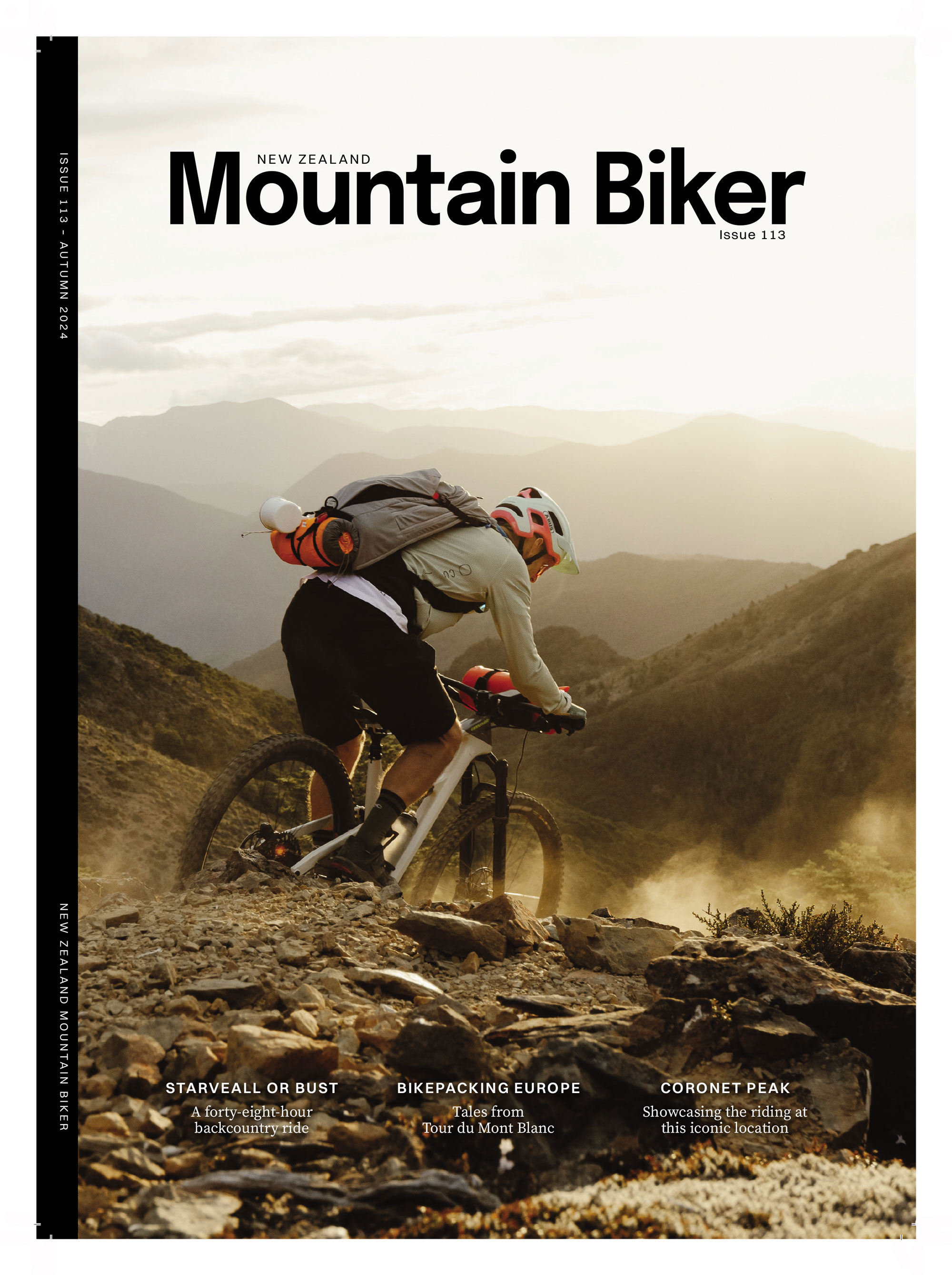

Words by Lester Perry
Images by Henry Jaine
WHILE ON A PREVIOUS TRIP, NELSON LOCAL, KIERAN BENNETT, AND I HAD DISCUSSED THE CHALLENGE OF DOING MULTI-DAY MISSIONS, OR SIMPLY EVEN SOLO OVERNIGHT TRIPS, WHILE JUGGLING WORK AND FAMILY COMMITMENTS. LET ALONE TRYING TO LINE OUR CALENDARS UP TO DO THEM WITH SOMEONE ELSE WHO WAS LIKELY IN THE SAME BOAT. SINGLE- DAY RIDES WERE GREAT, BUT REGARDLESS OF HOW EPIC THEY ARE – OR AREN’T – AN OVERNIGHTER HAS A CERTAIN ALLURE. WE TOSSED AROUND THE IDEA OF ME ARRIVING ON AN EARLY FLIGHT, DOING A FULL-DAY RIDE FROM NELSON AIRPORT TO A DOC HUT FOR THE NIGHT, THEN DEPARTING ON A FLIGHT LATE THE FOLLOWING DAY, AS A QUICKFIRE WAY TO PULL OFF AN OVERNIGHT BACKCOUNTRY MISSION.
Chatting with Kieran, he reckoned Mt Starveall and the Starveall track could be a worthy option, but details were scarce.
I’d heard rumours of people riding Mt Starveall in the past, so went on a hunt for more info. Indeed, people helicopter up to the summit and descend to the Hackett car park. Judging by the couple of aged YouTube videos I came across, it looked like a proper backcountry descent; things were looking positive. The internet offered up further details from people who had done the descent after accessing the trail from deeper in the Richmond Range, although only one blog post gave confirmation that people had actually clambered their way up the Starveall track before descending back down. Without a heli drop, an ascent on Starveall sounded like it may turn into some sort of twisted cross-fit style bike-carrying mission. But there was only one way to be sure: to physically take it on.
Dates were locked in, flights booked, and the route confirmed – there was no bailing out now. Late January, I spied a Strava ride from a friend; a heli drop from the top of Starveall. A few messages backwards and forwards confirmed it was a worthy trip, but also that we were deranged to be considering the hike-a-bike to the top.
Four-twenty in the morning is not a fun time to be woken for any reason, but needs must. By 4:30am I was dressed and had prepared a bottle of hydration mix and a quad shot of strong espresso to get me through the nearly two-hour drive to Auckland Airport. How ridiculous is it that it’s cheaper by a few hundred dollars – and almost quicker! – to drive nearly two hours, pay for gas and parking, and fly to Nelson from Auckland, than from my local Hamilton airport?! An overcooked breakfast muffin and a flat white; the obligatory Cookie Time and black coffee onboard, and after spinning for an hour and a half, the ATR 72’s props came to a shuddering stop outside the Nelson terminal.
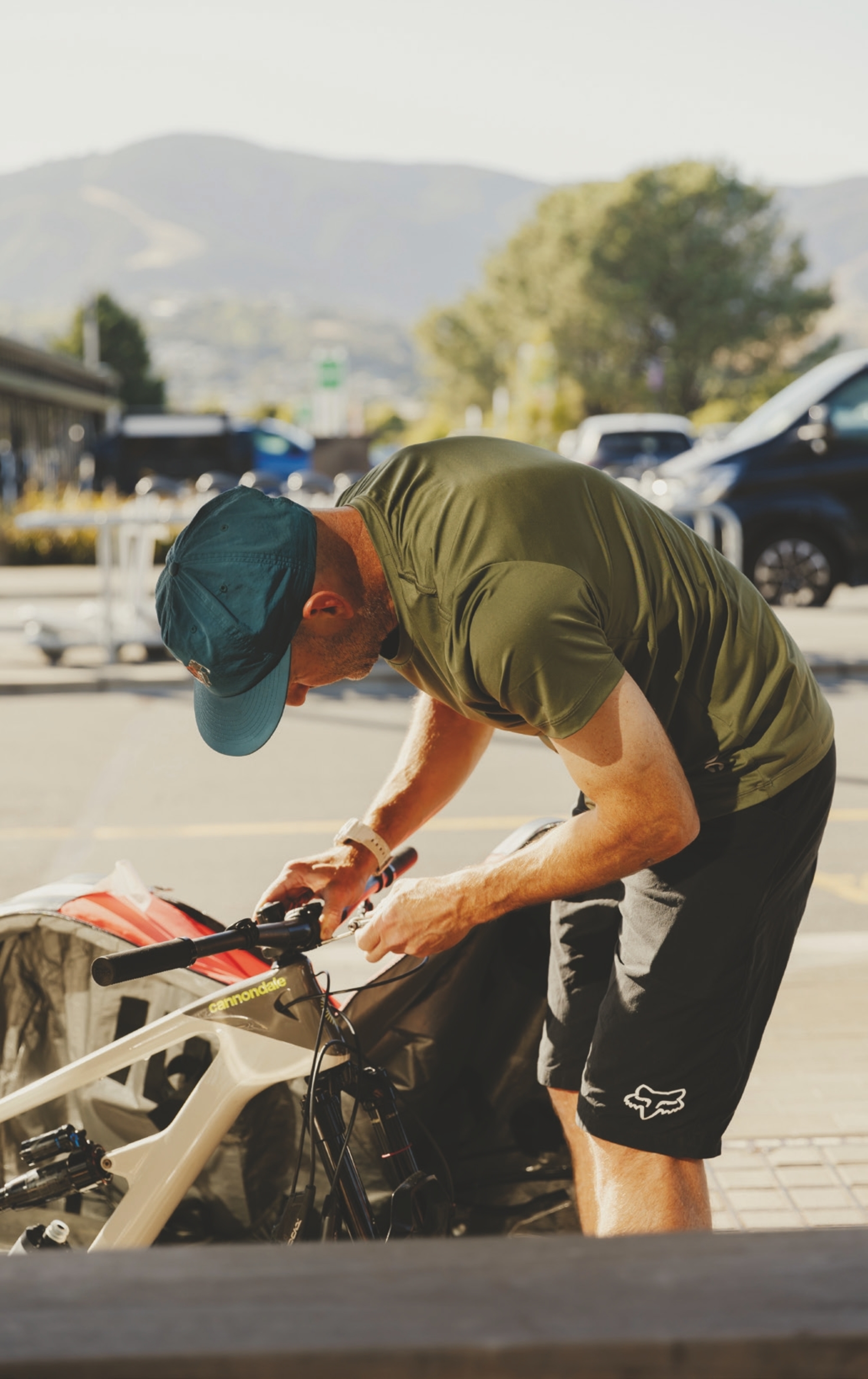
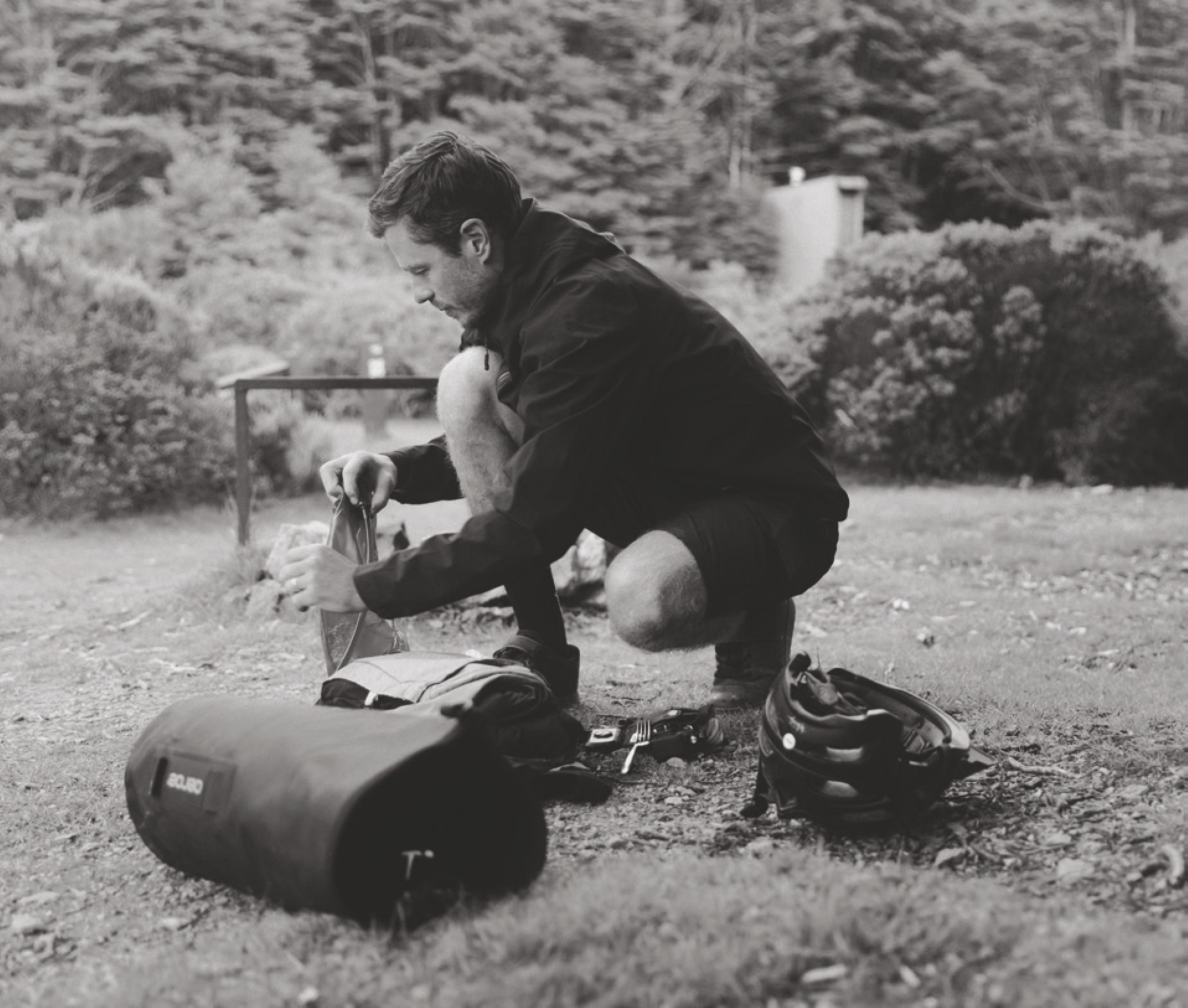
With Kieran Bennett laying the initial foundation for my route, it was only fitting that he came along; stupid ideas are best shared with friends and if it all went bad then I had someone to share the blame with. After a few minutes of spinning Allen keys, my bike was assembled. Once again, I attempted to whittle down my gear for the trip; necessities and nice-to-haves. Space was tight and we wanted to travel light. I stuffed what I could into a handlebar-mounted Aeroe drybag, filled every nook and cranny of a CamelBak HAWG Pro backpack with the remaining gear, and we were good to go.
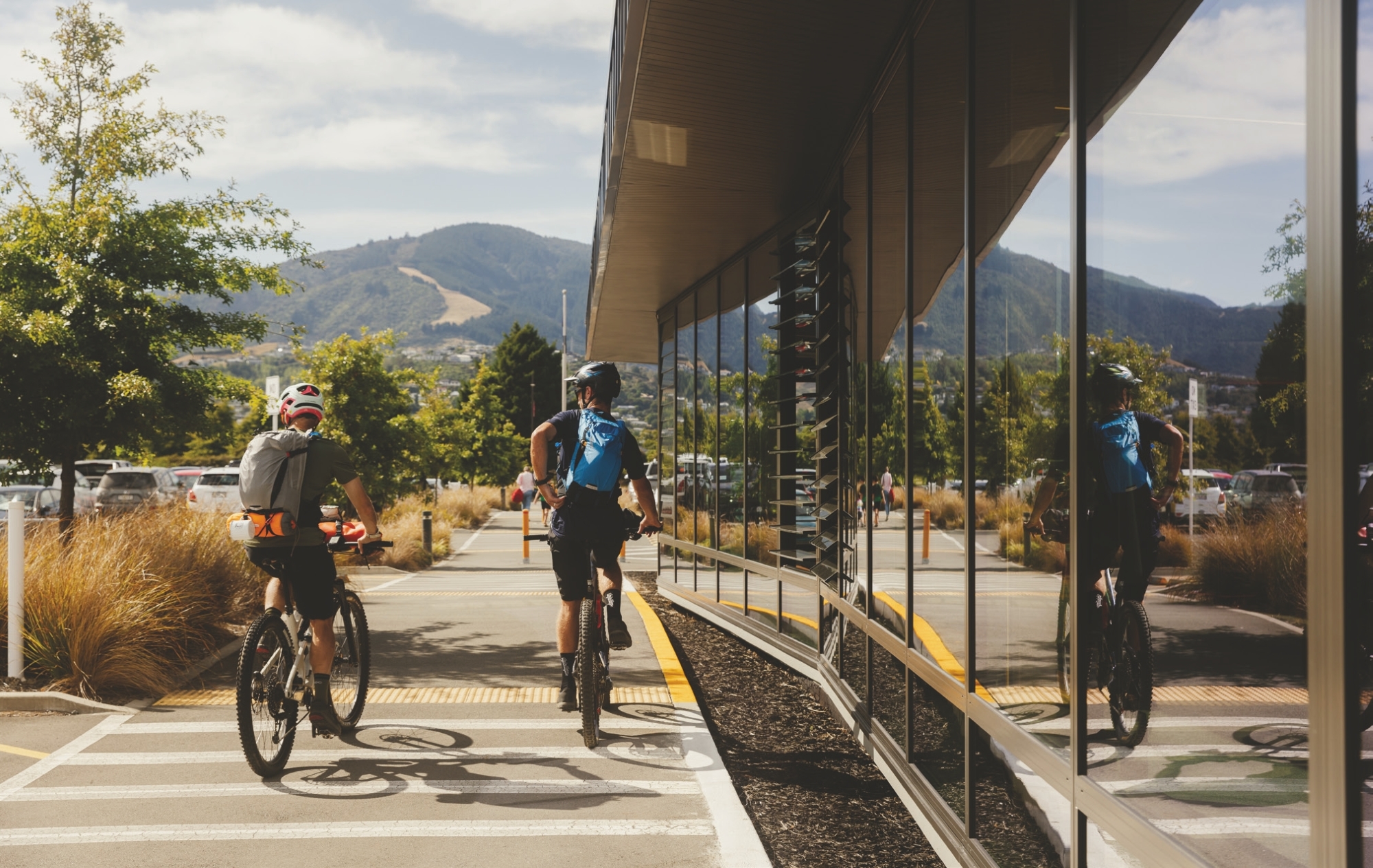
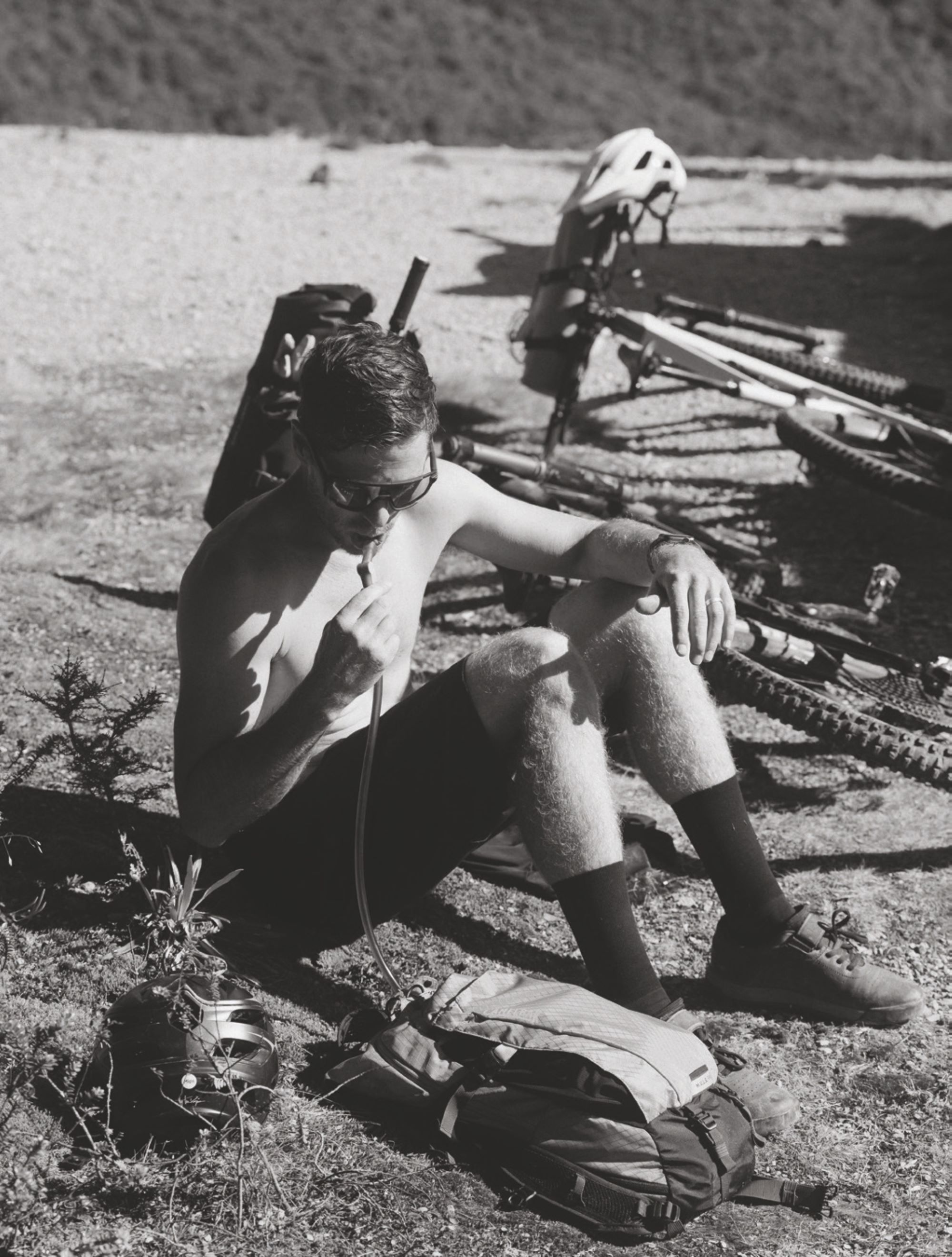
By 10:30 am we were ready to roll, but first; coffee and a butane canister. Butane for cooking, nothing nefarious. A quick stop at Bunnings ticked the final boxes on the admin list, providing the gas for the cooker and coffee for the body. It was game on. Continuing on the bike path, we began the mellow climb towards Silvan MTB Park. The day was warming up and the sun was out. It was here I remembered my sunscreen was still sitting at home.
Winding our way up through the forest of Silvan, our chat was flowing thick and fast. We calculated and theorised how long we’d take to reach our destination: Starveall Hut. It was getting hot and I was already sweating what felt like litres, yet we’d barely put a dent in the day. How long would my three and a half litres last me? If I kept drinking at the rate I was, not long!
As we reached the top of Silvan, we made the first of many snack stops. Half a sleeve of Oreos between us, a muesli bar and some mixed lollies. Over fistfuls of sugar, we broke out the maps again and were speculating how long the day would be. One thing was becoming apparent by this point: we had no accurate idea.
The quest for a route to suit the timeframe, began by spending time in my trusty Topo Map app. Focusing on the Richmond Range, I was hopeful I’d find a hut we could ride to directly from the airport. Tracing hiking routes on the map, cross-referencing with DOC information, Strava heat maps and the Nelson Trails website, there were a few options on the table, but I needed some local knowledge.
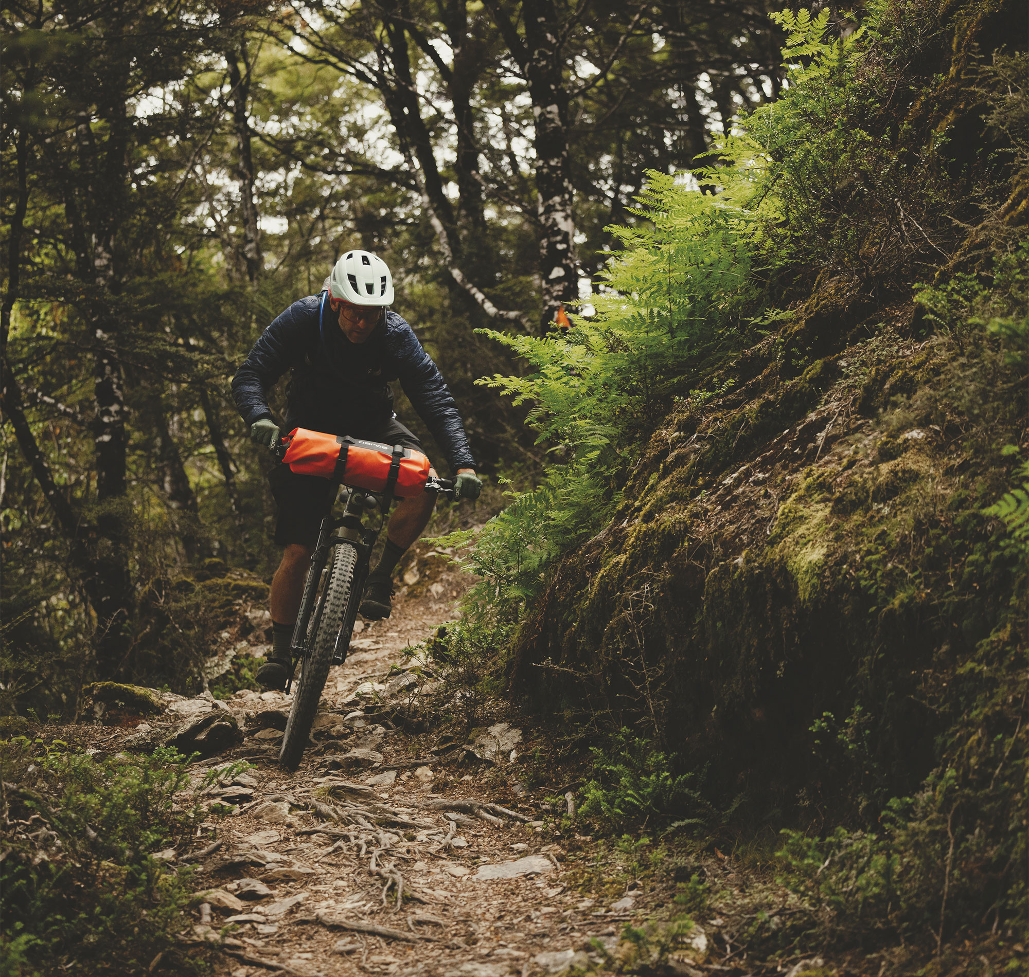
We dropped over the back of Silvan, descending gravel roads into Aniseed Valley towards Hackett carpark and the beginning of Hackett track. The track was a mostly mellow, well-formed affair and, aside from a couple of chunky sections for a few metres, it would be passable on a gravel bike. The track winds its way beside Hackett Creek for 5.8km, then spits you out in a grass clearing at the Hackett Hut. I’m sure the gas cooker and the half-tub of Vaseline that remain in the Hut have some tales to tell. With places to be and bikes to carry up hills, we pressed on. We left the hut and went from the mellow comfort of the gravel trail, to the unkempt wilds of the Starveall Track.
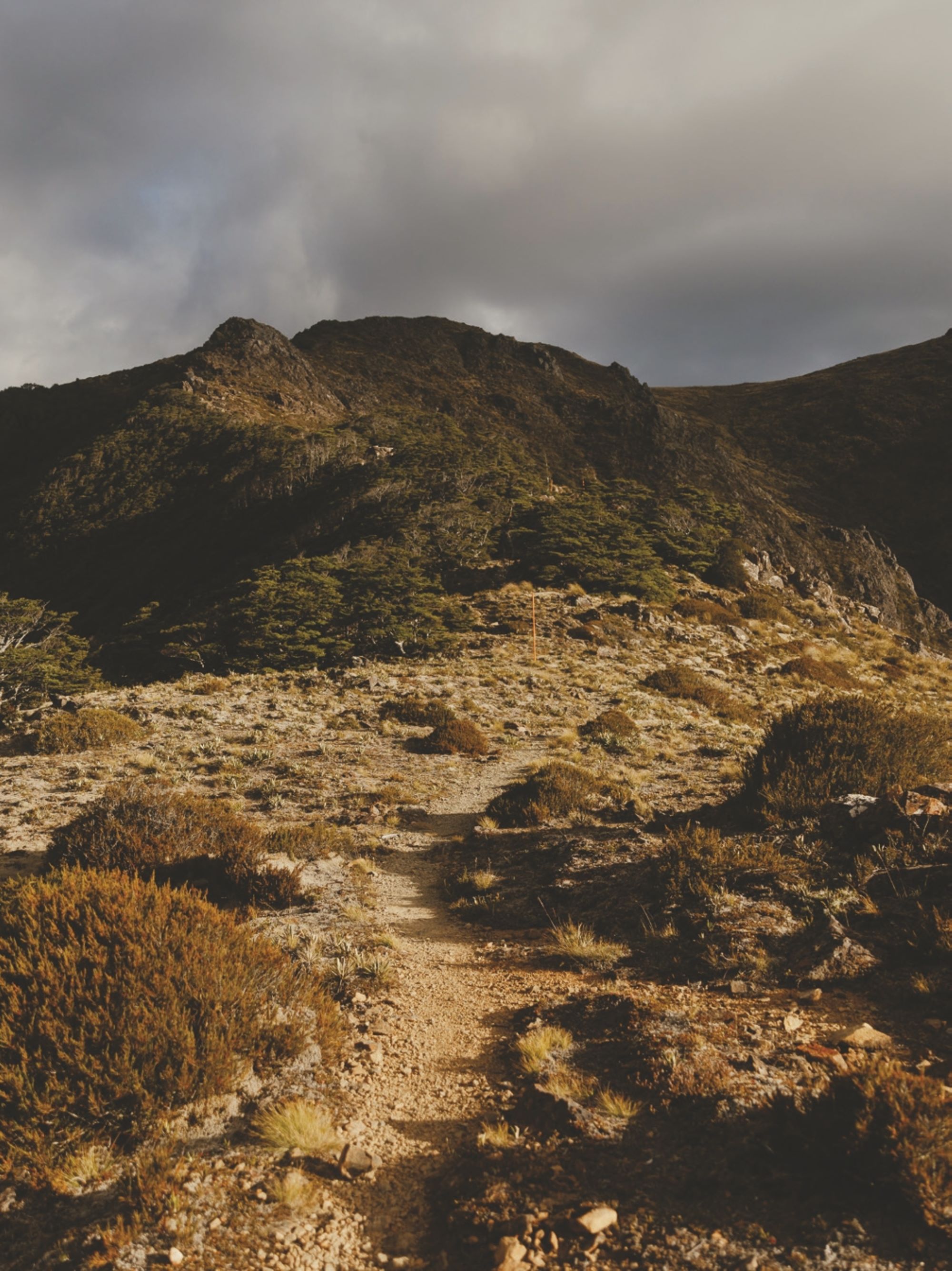
The story goes that Mt Starveall gained its name in the 1800’s after a stockman was looking for a route to drive his sheep from Nelson to Wairau Valley, attempting to dissect the Richmond Ranges rather than take a longer, albeit easier route around the valleys. Reaching the summit of what we now know as Mt. Starveall, he found there was no suitable feed for his sheep. Dismayed, he proclaimed the mountain would “starve all” his flock. Seems the name stuck.
I’m no stockman, and we had no sheep to take anywhere, but as Kieran and I were crossing the river for a third time in only a couple of hundred metres, I was wishing we could “starve all” the people who decided the trail needed to cross the river some nine, or maybe it was ten, times in a kilometre of track. Halfway across the river at one point, we met a hiker descending; a foreigner on his quest to complete the Te Araroa trail (which Starveall track is part of). The look of confusion on his face said it all: he seriously thought we’d lost the plot and was verging on visibly distressed that we were about to carry our bikes up this mountain. We silently wondered if maybe he was right.
I’m still surprised, after so many stream crossings and hundreds of footsteps sketchily balanced atop rocks that were at times smaller than a foot, that – thanks to grippy-soled, modern riding shoes, and us having the balance of ballerinas – we both managed to keep our feet dry!
Leaving the prospect of falling in a stream behind us, the gradient of the trail pitched up. Not just a bit but, for a period, a lot. Picture ‘climbing a hundred-metre-long staircase with your bike on your back’ sort of steep. We were into the meat and potatoes of our mission.
Leaving the prospect of falling in a stream behind us, the gradient of the trail pitched up. Not just a bit but, for a period, a lot. Picture ‘climbing a hundred-metre-long staircase with your bike on your back’ sort of steep. We were into the meat and potatoes of our mission.
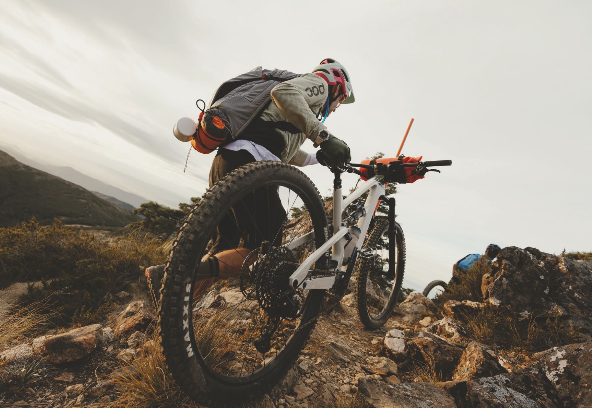
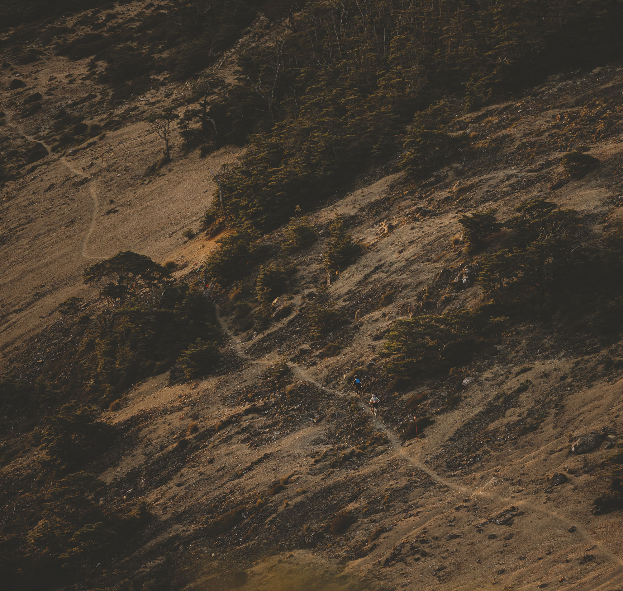
One foot in front of the other, we plodded our way up the hill. Our progress was slow – so slow that our Garmins no longer considered us as “moving”. For all intents and purposes, we were stationary. Forward movement was a mix of pushing our bikes, carrying them under an arm, or hoisting them overhead and carrying them on our shoulders. Early in the hike-a-bike, this hoist overhead was quick and easy, a rapid snap of the hips, and almost an Olympic Power Clean to get the loaded rig up to our shoulders, however, two hours into it our bodies were tiring. What was once a fluid, smooth hoist of the bike became a full-body effort, recruiting every muscle and ounce of strength to get it done. It seemed the higher we got in altitude, the heavier our bikes became. Fatigue sapped our dexterity and we were getting ourselves in all kinds of strife while trying to lower our bikes down once our shoulders had done their dash. Handlebars tangled in our packs, I somehow got the nose of my saddle caught under my helmet, and more than once we needed help to untangle ourselves from our bikes. Stopping for a second and surveying the map again, we wondered where Pyramid Rock was. The map showed it should be somewhere to our left, but we couldn’t see it. “Can’t be too exciting I guess…” we decided. Five minutes later, we spotted a break in the bush ahead and were greeted with a full view of the rock. It protruded from the end of the ridge we’d just come up, one side bush, the other an almost sheer rock face. It was a sight to behold and unique amongst the surrounding terrain. Again, we surveyed the map. We figured that in two hours we’d come two kilometres up the hill, and there was about two kilometres to go. Those salt and vinegar chips strapped to my handlebar bag were looking mighty fine at about that point. We cracked another One Square Meal and agreed the chips were our reward once we’d reached the hut.
At some stage, Kieran and I unleashed some brutal honesty. “How much of this are we even going to be able to ride on the way back down?” “This looks pretty gnarly, this better be worth the effort!” Fortunately, each time we looked back down the trail we’d just passed, it looked like – although some of it would be sketchy at best – we’d likely be able to ride a majority of it on our return journey. Sections, however, would remain untouched by our tyres.
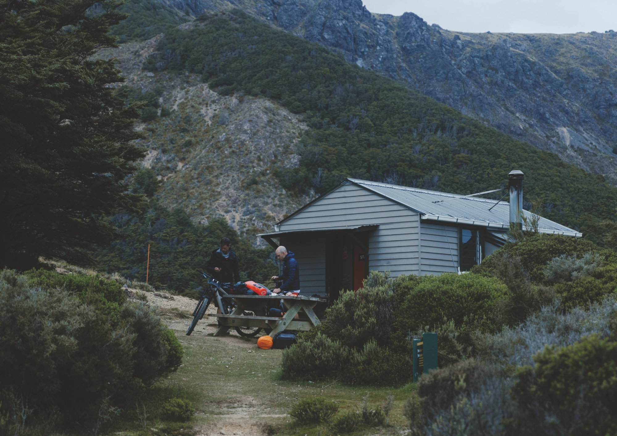
Kieran was up the trail a little from me as we neared the end of a janky-looking rock section when all of a sudden there was a change of tone, electricity in the air, and the exclamation: ‘‘There she is, there’s the hut!’’. Seven-and-a-half hours after we left the airport, we’d reached our destination; near on four hours of that was hike-a-bike.
Our rapid chat from earlier in the day had become stunted; small, solitary sentences and single statements rather than conversation. I’ve never been much of a classic hiker or bushwalker, but I sure would’ve loved to be one at that exact moment. Trade my stiff-soled shoes for some hiking boots, and swap the bike for some walking poles. That would’ve been amazing. As we shouldered our bikes to clamber up another steep pitch, we traded complaints about how the balls of our feet and our big toes felt as though they’d be blistered by day’s end.
We were pushing on but could only put so much effort in or we’d risk a complete meltdown. At times, it felt like there was a competition between my glutes, hamstrings, and quads for which one would be the first to snap like an over-stretched rubber band, or burst forth from my skin. I pondered this and draped my arms over my handlebars during a quick breather, hoping to shake the niggle of cramp in my right arm. It was a cramp like I hadn’t felt before; maybe it was a special breed of hike-a-bikers cramp, one that shows up only after hours of carrying one’s bike.
I was slowly cooking. It was hot and muggy and I’d already syphoned through most of the three litres in my CamelBak before we left the river crossings earlier in the day. I was verging on being the sweatiest I’d ever been – at times looking like I’d just stepped out from the shower! Experience told me to never leave a water source without supplies topped off unless I know where the next water source is. Fortunately, I’d refilled from the last of the streams earlier in the day. I was nervous we might arrive at Starveall Hut to find empty water tanks, drained by over-eager Te Araroa Trail walkers, and although I had read that DOC had installed an additional tank recently to help avoid the hut supply running dry, I still wasn’t 100% confident, so was keen to arrive with as much water onboard as possible. As it ended up, I blew through that refilled 3-litre bladder, and another bottle, arriving empty at the hut.
Our stops were becoming more frequent, and our snack supply was getting low. Conscious we had to ride out the following day, I didn’t want to devour all our food. Silently, in my mind, I tried to justify eating just one more mini Snickers and another few lollies; “If I eat them now, I’ll be better recovered for tomorrow and won’t need them then anyway”. Makes sense, right? Shouldering the bike after each break was becoming increasingly difficult but I managed “just one more” and we’d set off again. Kieran was up the trail a little from me as we neared the end of a janky-looking rock section when all of a sudden there was a change of tone, electricity in the air, and the exclamation: “There she is, there’s the hut!”. Seven-and-a-half hours after we left the airport, we’d reached our destination; near on four hours of that was hike-a-bike.
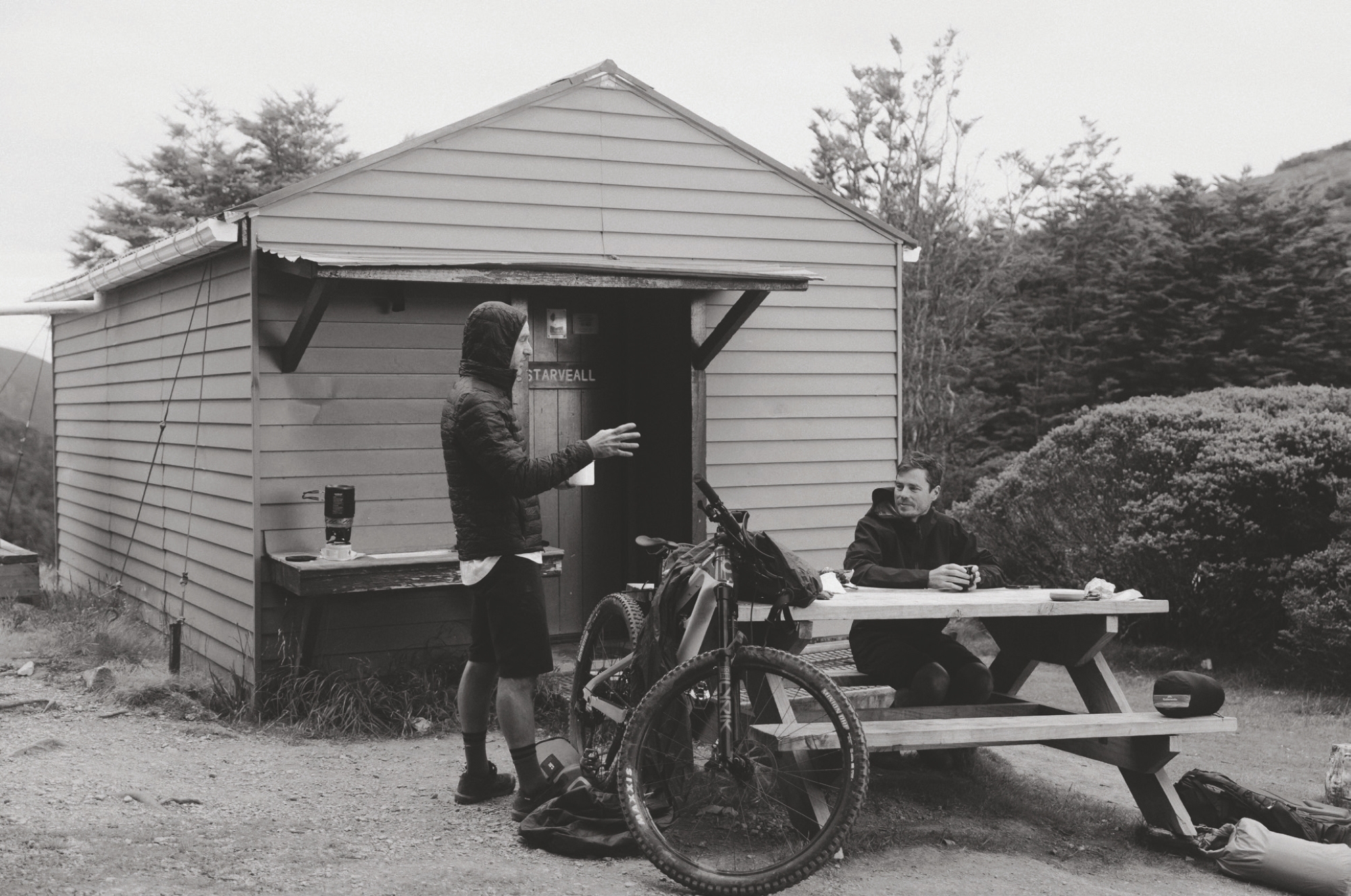
We downed the bag of salt and vinegar chips and nabbed ourselves a bed before the six-bed hut was filled with hikers. After blitzing all my water en route, I headed to the water tank for a refill. “The water here will be sweet straight out of the tank, no need for a filter” I was reliably informed by a hiker who’d arrived hours earlier. Filling my bottle, I thought I’d seen something drop from the tap – on closer inspection there was something. “A fish?” someone shouted, tongue-in-cheek. It did look like a fish, albeit a very small three or four-millimetre-long one. It seems it was some sort of strange bug or large parasite. Tipping my water on the ground I pulled out my trusty water filter and swore to filter everything from then on.
Hoping to score some golden evening hues and ’God Rays’, we headed uphill towards Starveall’s summit. Reaching what was essentially a cliff face, we decided enough was enough and parked our bikes at the foot of it. The views from on top (although not quite the Starveall summit) were amazing. Lush native bush as far as the eye could see, only broken by the highest peaks, scarred by their lack of vegetation. Such was the expanse before us, I struggled to grasp the true scale of the peaks and valleys around me. Our sunset party was almost ruined; the only gold we got was in the gaps between clouds passing overhead. Regardless, it was a magical evening I’ll never forget.
All too quickly, we popped out to Hackett Creek and all its crossings. Knowing wet weather was on the way in only a few hours, we theorised how high the river may get, relieved to still have plenty of stepping stones to cross dry-footed. Had we drawn our morning out while up at the hut, things could have been very different.
Climbing the ladder to my bunk polished off my remaining energy; figuring out how to flatten my sleeping bag out while turning around under the low ceiling polished off any remaining enthusiasm I had for the day. Sleep was needed. As I drifted off, I could hear a gnawing sound. Thinking there was a rodent in my bag, and fuelled purely by adrenalin, I slipped out of the fart sack, down the ladder and grabbed my bag. No rodent. Remembering I had earplugs, I grabbed those; if I can’t hear a mouse, it doesn’t exist – right? It wasn’t until I was home and sorting through gear from the trip, I discovered a bag of nuts with a hole the size of a mouse’s head chewed right through the side of it!
Woken by a dull ray of light trickling through the louvred window across from me, I tried to move. Creaking and groaning, I managed to get my body off the bed and contort myself down the ladder, heading outside to see if we needed to scramble to shoot the sunrise. We didn’t. I stood in the one square metre where we were able to get phone signal; the latest weather maps told me the wind had increased and the weather previously due to arrive late in the day, looked like it would now hit around lunchtime. Great.
The lads rose from the crypt, drawn from their cocoons by the smell of coffee and porridge wafting their way. We devoured cups of porridge complete with mini Snickers melted into them, and we were set for the day. It was right about then I realised I hadn’t brought a skerrick of toilet paper with me and everyone else was down to the bare minimum. Thankfully the porridge I’d just cooked came in six little paper packets!
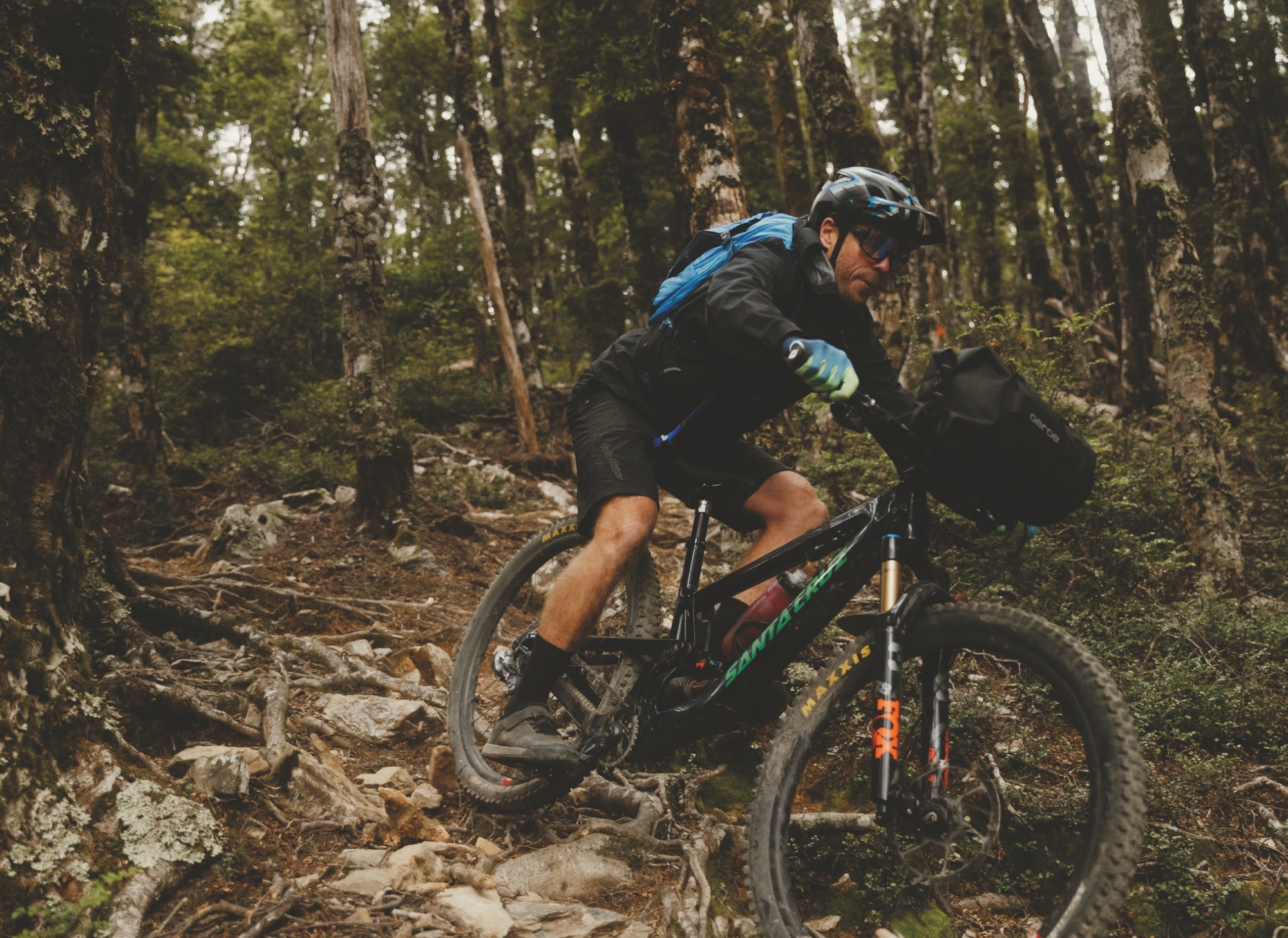
We were eager to get off the mountain before the weather hit so crammed our bags with our gear and set off for phase one of our transit back to the airport. From the hut, we rolled straight into the lush beech forest. Within metres, we were dealing with a chute of shifting rock and sketchy roots; a heck of a way to wake the body up. Kieran and I were both surprised by how ridable most of the terrain was. During the hike up, sections looked like we’d be doing as much walking down as we did up, but we were cleaning most of them with relative ease.
Careful to keep our speed in check, we continued down; a hop over roots here, a Scandi’ into a corner there, a foot out to stay upright and a few “oh crap” almost over the bars moments. We were loving it. There were a few sections it would have been plain irresponsible to ride – the risk simply not worth the reward – other sections were comfortably ridable, although strewn with rocks, roots, moss and beech leaves, meaning we had to be vigilant.
As with the climb up, there were some challenging sections on our descent. Picking our way down, the trail would slowly tip steeper to the point it felt near vertical, heading straight into a ravine where a stream lay. Keeping our wits about us, we made sure we didn’t stay on the bike too deep into these sections, ensuring we shut down our speed and came to a comfortable stop before we slid our way off the side of the hill, into a stream. Had we got this all wrong, an extraction would have been tricky or near impossible.
All too quickly, we popped out to Hackett Creek and all its crossings. Knowing wet weather was on the way in only a few hours, we theorised how high the river may get, relieved to still have plenty of stepping stones to cross dry-footed. Had we drawn our morning out while up at the hut, things could have been very different.
We reached the top of Silvan just as the weather hit. What felt like teaspoon-sized raindrops blew in from the south-west. Of course, I packed my jacket right at the bottom of my pack.
Arriving at the car park to the sound of a saxophone blaring, we spied a local gent taking advantage of the acoustics of the area. We paused and listened for a time; he was no Kenny G, but he was a whole lot better than I was when I was trying to learn at age 12.
Minutes into the grind back over to Silvan, we were starting to see the weather move in. The odd rain spot fell and the wind was getting up, the signs of things to come. Conversation had dried up by this point; we were getting tired and, knowing this was the final ascent of the day, we were focused on the task at hand.
We reached the top of Silvan just as the weather hit. What felt like teaspoon-sized raindrops blew in from the south-west. Of course, I packed my jacket right at the bottom of my pack. I emptied the bag and while trying to stop its contents from blowing away, eventually retrieved the jacket and battled with the wind to get it on.
We started the descent on a sensible trail, People’s Choice. It was a far cry from the tech of hours earlier, but a welcome change given the weather. Barely pedalling, we pumped our way down several of Silvan’s digger-built flow trails. Kieran’s ease of generating speed, fluid style, and effortless cornering reflect his previous years’ racing downhill around the globe, only this time he had a heavily loaded handlebar bag and backpack. Towards the exit, and on familiar trails, Kieran lets the speed run. Regardless of the fully loaded bike, he was gapping doubles, jumping out of wallrides and coming into corners faster than he should have – a casual masterclass in descending and bike control.
Leaving Silvan’s gates, we were stoked – what a time the last couple of days had been. The remaining ride from there was merely a formality, or so we thought. A pizza and a brew at Eddy Line Brewing satisfied our cravings and prepared us for the last few kilometres to the airport. Fed and back on the bikes, the storm was starting to show itself; winds were swirling, branches and leaves were flying, and rain sporadically smashed us from all directions. The wind, oh the wind. It felt like we were riding up a hill as we headed along the pan-flat bike path to our destination. With Kieran half a wheel ahead, the roadie in me had quietly picked the downwind side of him, I managed some shelter from the crosswind, easing the strain a little.
Some 37 hours after I’d left my car, I arrived home, having conquered a mission from Te Awamutu to Auckland, onto Nelson, up Mt Starveall, and back again. Mission complete and many memories banked.
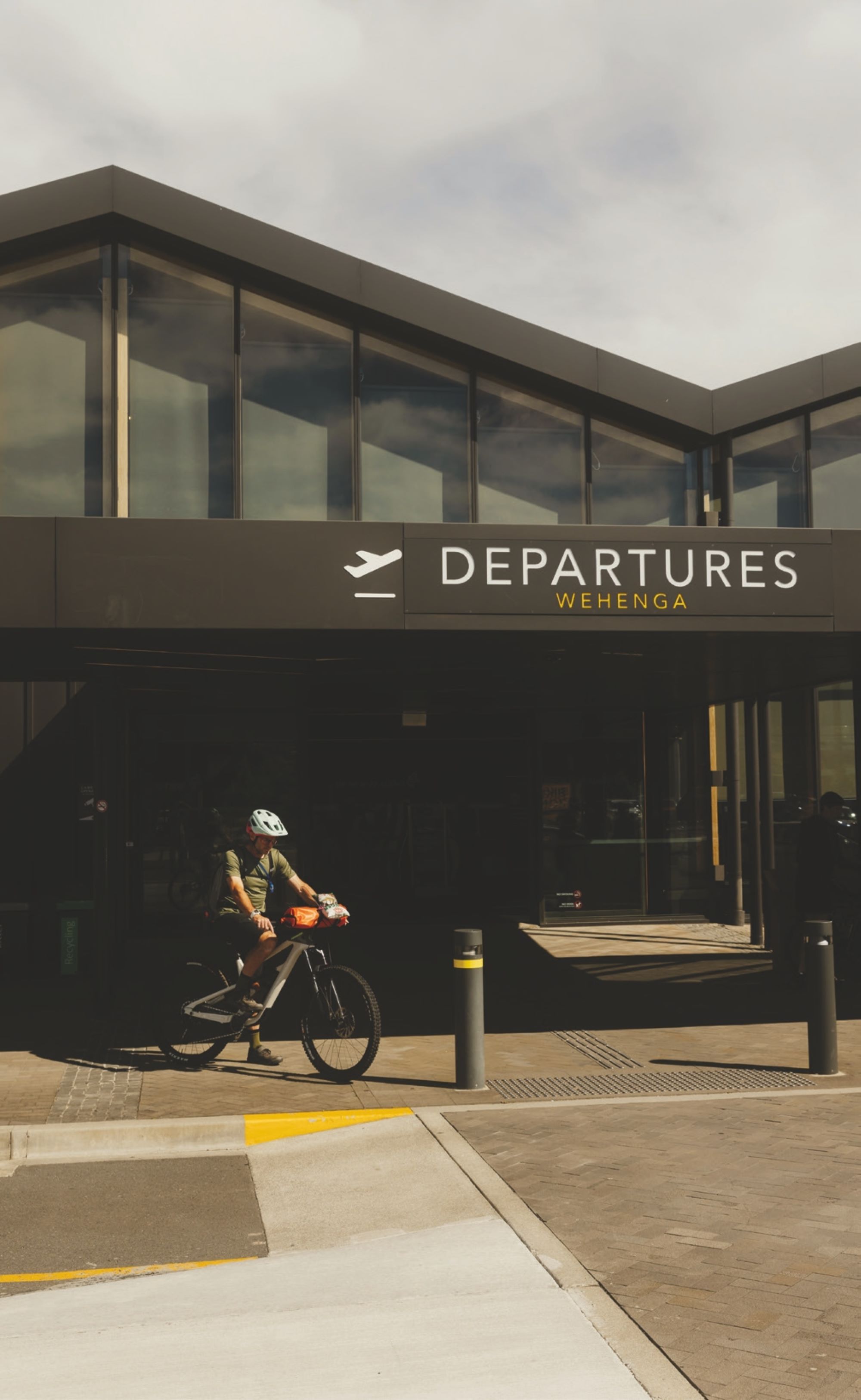
The rain held off just long enough for me to pack my bike in its bag. As I closed the final zip, the heavens opened. A short dash to the terminal doors 50 metres away and I was properly damp. I removed my filthy shoes and socks, stashed them in my backpack and checked in for my flight.
I took a step back from the flight attendant as I paid my excess baggage charges, hoping she couldn’t smell me after two days of sweaty riding. My bike rode the conveyor through the gate and I walked off, only to be chased by the attendant. “What did I leave in my bag?” But she was simply confirming I did have shoes for the flight. I’m surprised she wasn’t checking I was going to shower before boarding; which is exactly what I was headed to do. Thankfully, for my fellow passengers, Nelson Airport has a shower, so I wouldn’t be taking my stench on the plane! Warm water blasted away the sticky dirt of the previous days, but didn’t take care of the biddy bids stuck to my legs, those required some manual labour.
Hosed, but not quite home, I boarded my flight back to Auckland; the memories of the previous two days all blended together, one day now barely distinguishable from the other. My aches and pains seemed to remain on the tarmac as we lifted off, although I knew they’d return when I woke the following morning.
Some 37 hours after I’d left my car, I arrived home, having conquered a mission from Te Awamutu to Auckland, onto Nelson, up Mt Starveall, and back again. Mission complete and many memories banked.